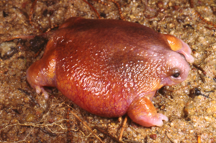
Turtle frog (Myobatrachus gouldii)
- Turtle frog is unique to Western Australia, and it subsists on termites.
- It is mainly found in the semi-arid region in the southwest and central zones of west Australia.

- It is very small and on average are around 2 inches (5cm) in length.
- It has short and muscular limbs which help them dig into the ground.
- It digs forward like turtles, rather than backwards which is characteristic of frogs.
- The turtle frog species does not have a tadpole stage; instead the frog develops fully inside the egg.
Dead Zones
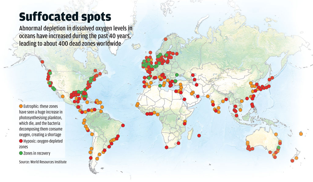
- The Gulf of Mexico’s annual “dead zone” will likely persist for decades.
- Hypoxic zones or Oxygen minimum zones (OMZ) are areas in the ocean of such low oxygen concentration that animal life suffocates and dies, and as a result are sometimes called "dead zones."

- In dead zone area most marine life either dies, or, if they are mobile such as fish, leave the area.
- Habitats that would normally be teeming with life become, essentially, biological deserts.
- One of the largest dead zones forms in the Gulf of Mexico every spring.
- Nutrients such as nitrogen flow from North America's Corn Belt through streams and rivers before ending up in the Gulf.
- The dead zones or Oxygen Minimum Zones (OMZ) in the Arabian Sea have been growing in size.
- It is the thickest and the most intense OMZ among the world’s oceans and covers an area of around two million sq km.
Integrated Management of Public Distribution System (IM-PDS)
- IM-PDS is central sector scheme that has been approved for implementation during 2018-19 and 2019-20.
- The key objectives of the scheme are
- To integrate PDS system/portals of States/UTs with Central System/portals,
- Introduction of National Portability
- De-duplication of ration cards/beneficiary
- It will bring more transparency and efficiency in distribution of food grains.
Drought Hit regions
- The Kerala State government has decided to declare nine districts as drought hit recently.
- According to the India Meteorological Department (IMD), there was considerable shortfall in rain during the North East Monsoon and also predicted serious drinking water shortage in these districts.
- The five categories of indices listed in the Manual for Drought Management released by Ministry of Agriculture and farmer’s welfare include
- rainfall
- agriculture
- soil moisture
- hydrology
- remote sensing (health of crops)
- State Government can declare drought in the State or parts thereof.
- Financial Assistance is provided through the Calamity Relief Fund (CRF) / State disaster response fund maintained by the state under the administrative jurisdiction of state disaster management departments.
- After drought is declared, if the funds available under CRF /SDRF are inadequate for meeting relief expenditures, the State Governments may consider submitting a Memorandum for assistance from the National Calamity Contingency Fund (NCCF) / National Disaster Response Fund.
- Moderate drought is no longer eligible for relief funds from the Centre.
- Only if the calamity is of “severe nature” can the state governments submit a memorandum for financial assistance under the National Disaster Response Fund.
Mega fauna
- The word 'mega fauna' means big (mega) animals (fauna).
- At present, there are only 101 species of big, land-dwelling wild animals in the world.
- Biologists warned that this modest number of species is sure to shrink to double digits, and could continue to diminish at an alarming rate.
- Two-thirds of these iconic creatures are listed as threatened with extinction by the International Union for the Conservation of Nature (IUCN).
- The Saharan Addax antelope, Eastern Gorilla, orangutans of Borneo and Sumatra are some of the species which are in the path of extinction.
- Over the course of the last century,
- Lions, rhino and cheetah populations have collapsed by more than 90 %
- Giraffes are down by 40 % in just three decades
- Polar bears are forecast to lose a third of their numbers by mid-century.
- Scientists agree that Earth has entered a so-called “mass extinction event” in which species of all sizes and shapes are disappearing at 100 times the normal rate.
Kaziranga National Park
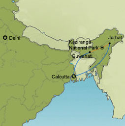
- The rhino census at the Kazaringa National Park has begun.
- The Park lies partly in Golaghat District and partly in Nagaon District of Assam.
- It is the oldest park in Assam along the river Brahmaputra on the North and the Karbi Anglong hills on the South.

- It is UENSCO World Heritage Site, which is home to two-thirds of the world's population of the species.
- The landscape of Kaziranga is of sheer forest, tall elephant grass, rugged reeds, marshes & shallow pools.
- Along with the iconic Greater one-horned rhinoceros, the park is the breeding ground of elephants, wild water buffalo, and swamp deer.
- The park is also a Tiger reserve.
Map of the Day
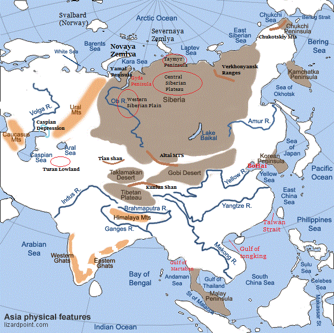
Asia Physical

- Bo Hai, also called Gulf of Chihli, is the shallow northwestern arm of the Yellow Sea, off the northern coast of China.
- Much of Caspian Depression area is below sea level at the north end of the Caspian Sea which is one of the largest such areas in Central Asia.
- Both Ural and Volga drain through the depression into the Caspian Sea.
Source: PIB, The Hindu, Business Standard


