Chief ministers of both the states of Assam and Arunachal signed memorandum of understanding (MoU) to resolve the long-standing border dispute.
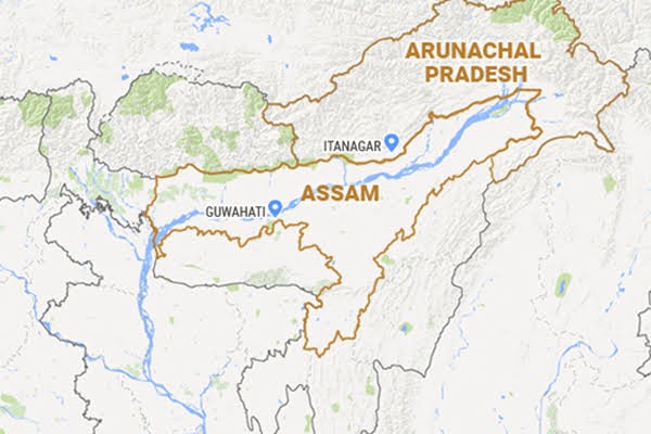
What is the border dispute between the two states?
During the formation of Arunachal Pradesh in 1954 around 3500 kms plain area were transferred from Arunachal Pradesh to Assam.
When Arunachal Pradesh was made as union territory in 1972 the areas belonging to hill tribal chiefs of Arunachal Pradesh was unilateral transferred to Assam.
What are the earlier efforts taken to resolve the dispute?
High-powered tripartite committee - Was constituted to delineate the boundary on the basis of Survey of India maps.
Around 489 km of the 800 km were demarcated by 1983-84 but it was not accepted by Arunachal Pradesh.
Local boundary commission - Several recommended were made including
Arunachal Pradesh to have back it’s territories
Both states should arrive at a consensus through discussions.
123 villages - Border dispute to be confined to 123 villages of Arunachal Pradesh.
Notified boundary - Boundary line delineated by the high powered tripartite committee in 1980 would be taken as the notified boundary.
12 regional committees - Was constituted covering the 12 districts of Arunachal Pradesh and the 8 counterpart districts of Assam for joint verification of the 123 villages.
Namsai Declaration - The dispute over 37 of 123 villages had been resolved with the signing of the Namsai Declaration.
What are the shortfalls of the MoU?
Tirap, Changlang and Longding People’s Forum (TCLPF) has said that the MoU is totally against the interest of people of Arunachal Pradesh.
The people of 13 villages on either side of the border strongly opposed the boundary deal.
The ground survey was done leading to faulty factual positions of the villages in the border.
The MoU was not taken considering the opinion of the village people.
Quick facts
The two states share a roughly 800-kilometre long border.
Arunachal Pradesh was formed in 1954 by carving out of Assam.