0.2026
7667766266
x

Worries about Brahmaputra

iasparliament Logo
November 28, 2017

What is the issue?

  • China plans to build a 1,000-km tunnel to divert water from the Brahmaputra in Tibet to the dry Xinjiang region.
  • This has created worries about Brahmaputra getting dried up, especially in Assam.

What constitutes the drainage route of Brahmaputra?
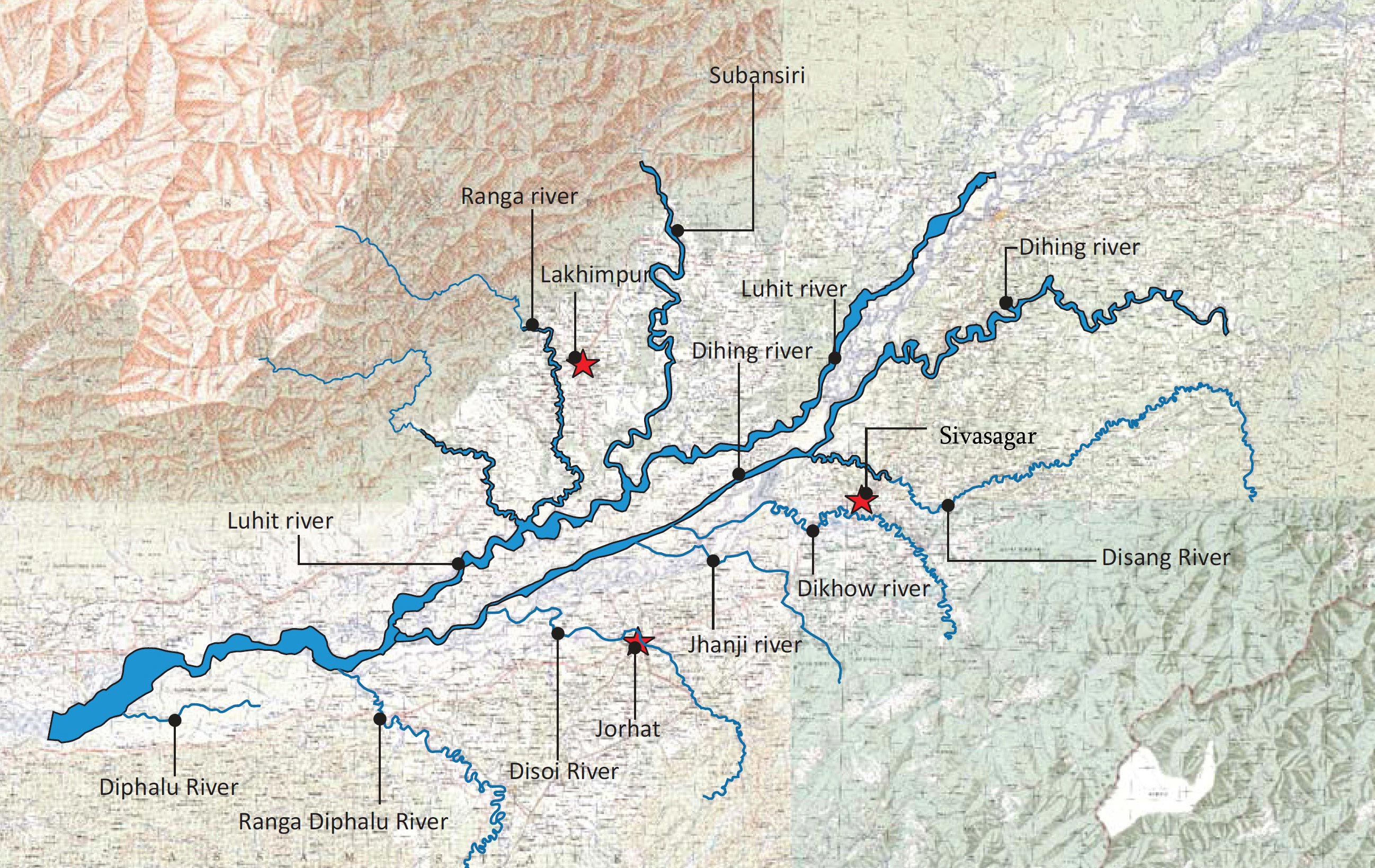
  • Out of the total length of the Brahmaputra of 2,880 km, 1,625 km is in Tibet flowing as Yarlung Tsangpo.
  • 918 km is in India and known as Siang, Dihang and Brahmaputra.
  •  The rest 337 km in Bangladesh has the name Jamuna till it merges into Padma near Goalando.
  • As a trans-Himalayan tributary, Yarlung is substantially fed by snow and glacial melts, in addition to rainfall.


Why India shouldn’t be worried?

  • There fears are hardly based on objective data-based analysis.
  • Melting snow contributes merely 15-20% of the total volumetric discharge of the river.
  • Catchment - With the Himalayas acting as the barrier, Tibet is a rain shadow region with an annual precipitation of about 300mm.  
  • As the tributaries cross the Himalayan crest line, the annual average precipitation reaches about 2000 mm.
  • Hence, a very large component of the total annual flow of Brahmaputra is generated to the south of the Himalaya in India.
  • Flow Rates - While the total annual outflow of the Yarlung River in China is estimated around 31BCM, the same for Brahmaputra towards the end at Bahadurabad in Bangladesh is about 606 BCM.
  • Further, the peak flows at the ‘Tsela Dzong’ measuring station near the great bend in Tibet, is about 10,000 cumecs.
  • But the peak flow at downstream Guwahati is around 40,000 cumecs and at Bahadurabad in Bangladesh is 50,000 cumecs.
  • Similarly, during the lean season, flows at the mentioned locations read 400 cumecs, 4000 cumecs, and 5000 cumecs respectively.
  • Implication – The above data implies that the Brahmaputra gets fatter and mightier as it flows further downstream.
  • This is also because of the contributions of various tributaries like Dibang, Luhit, Subansiri, Manas, Sankosh, and Teesta.

Can water diversion affect sediment flow?

  • Currently downstream Brahmaputra carries a huge sediment load on its run towards the sea.
  • River volume in the Yarlung River is not sufficient to generate and transport large sediment load.
  • Notably, the annual suspended sediment load near the Arunachal border in Tibet is around 30 million metric tonnes.
  • This is miniscule when compared to 735 million metric tonnes at Bahadurabad in Bangladesh.
  • Therefore, the large sediment load is created only in the downstream region in India.

What is the way forward?

  • In the case of Brahmaputra, initial evidence suggests that Chinese diversions can’t have a substantial impact on the Indian and Bangladeshi drainage networks. 
  • It should be understood that structural interventions does not always reduce downstream flows.


Source: Business Line

Login or Register to Post Comments
There are no reviews yet. Be the first one to review.

ARCHIVES

MONTH/YEARWISE ARCHIVES

sidetext
Free UPSC Interview Guidance Programme
sidetext